


Phillips CME Church, Madison County, Alabama
About
Outline

Summary
| Unique Area Identifier | 522348 |
| Name | Phillips CME Church |
| County | Madison County |
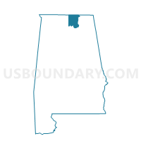
| State | Alabama |
| Area (square miles) | 0.42 |
| Land Area (square miles) | 0.41 |
| Water Area (square miles) | 0.01 |
| % of Land Area | 98.51 |
| % of Water Area | 1.49 |
| Latitude of the Internal Point | 34.72280960 |
| Longtitude of the Internal Point | -86.58928380 |
Maps


Graphs
Select a template below for downloading or customizing gragh for Phillips CME Church, Madison County, Alabama


Neighbors
Neighoring Voting District (by Name) Neighboring Voting District on the Map
- Charles Stone Agricultural Center, Madison County, AL
- Eastside Community Center, Madison County, AL
- Huntsville Middle School, Madison County, AL
- Southside Bapt Church, Madison County, AL
- Terry Heights School, Madison County, AL
- West Huntsville Elementary School, Madison County, AL
- Westside Neighborhood Center, Madison County, AL
Top 10 Neighboring County Subdivision (by Population) Neighboring County Subdivision on the Map
Top 10 Neighboring Place (by Population) Neighboring Place on the Map
Top 10 Neighboring Unified School District (by Population) Neighboring Unified School District on the Map
Top 10 Neighboring State Legislative District Lower Chamber (by Population) Neighboring State Legislative District Lower Chamber on the Map
Top 10 Neighboring State Legislative District Upper Chamber (by Population) Neighboring State Legislative District Upper Chamber on the Map
Top 10 Neighboring 111th Congressional District (by Population) Neighboring 111th Congressional District on the Map
Top 10 Neighboring Census Tract (by Population) Neighboring Census Tract on the Map
- Census Tract 21, Madison County, AL (3,495)
- Census Tract 19.01, Madison County, AL (3,386)
- Census Tract 12, Madison County, AL (3,380)
- Census Tract 31, Madison County, AL (2,982)
- Census Tract 20, Madison County, AL (2,095)